

Geography of Montignies-Lez-Lens
At the heart of a very diversified landscape, the village of Montignies-lez-Lens is mainly located in the valley and on the sunny side of the Marquette. This stream, formed by the confluence of three small streams which meet in close sequence, flows into the eastern Dender where the latter makes a clear bend towards the north. The hydrographic network, particularly dense on the territory of the locality, initiates a specific relief and gives a typical landscape both to the main valleys, that of the Dender and that of the Marquette which is perpendicular to it, and to the secondary ones.
The first valley, that of the Dender, is initially quite wide and bordered by a thick wooded cordon from Lens, which forms both the link and the break between the two localities and thus offers them a high quality green environment. The river narrows as it approaches the confluence, at a place called Les Bouloirs where the landscape changes and is characterized by well-preserved hilly meadows.
The latter, sometimes very deep, are gently traversed by the watercourse and planted with isolated trees or wild groves.
The second valley, crossed by the discreet Marquette stream, reveals steep slopes in the heart of the village, after the meeting of the three currents coming from the east of the territory. The hillsides are clearly visible along the paths and relatively steep side streets that connect the top of the village to the valley.
As for the small secondary water currents, called the Coulturelle, Brincheuil and Bois d'Irchon streams, they also form more tenuous valleys, while irrigating the meadows that accompany them. The last two, however, cut into the land more markedly as you approach the Val de la Marquette.
In addition to the meadows which occupy the periphery of the building and follow the courses of the various rivers, thus forming a crown planted with groves or willows in the village, the territory of Montignies is covered with vast cultures.
Established along the ridge road leading from Lens to Soignes, the village occupies a small promontory, formed by the confluence of the two rivers, it stretches from the break in the slope to the plateau. Installed at the hinge between meadows and fields, the locality is at the start of the vast agricultural plateau whose wide open fringe directly borders the buildings to the north.

There the fields extend as far as the eye can see, unlike the rest of the belt, which is more hilly, visually more closed and wooded.
The building thus stretches from Les Bouloirs and the Long Bridge before splitting into the bottom of the Marquette valley, along Rue Basse. Two narrow streets connect the upper and lower parts and run down the relatively steep hillside where a few houses stand. Three paths complete the internal circulation network of the village. Relatively dense in the center, the building is scattered more and more loosely, along a few secondary roads such as the one leading to Quesniau. There are scattered rare small farms, in the heart of gently rolling meadows and planted with willows or poplars.
Farther away, and mainly close to the Dender, are the large quadrilateral farms which, built halfway up the slope, are isolated in the middle of their land.

As for the medium-sized farms, fenced or semi-fenced, they have settled on the edge of the village, in the immediate vicinity of the agricultural areas. Finally, a few old, smaller long farms mingle with the dwellings within the village itself. The latter is grouped around the church, surrounded by its cemetery, whose dominant position offers a visual pole to the locality.
The roads, still often paved until the repair of the roads (2010-2011), meander smoothly and widen at the crossroads, opening up perspectives inside the village. The widening of rue Degauquier, at the outlet of rue des Écoles, thus opens up a long triangular space serving as a square whose urban interest is reinforced by the morphology of the building, which presents a uniform size. A second square of the same shape emerges in the rue Basse, but is less structured by the buildings. The approaches to the road, made up of numerous property walls or hedges and embankments also define the quality of public spaces, which are relatively closed.
Apart from the old long farms, it is the dwellings, low or two-storey, rural or urban, which make up most of the center of the locality. Most of them, established flexibly along the roads, are built adjoining but in setbacks, which gives a lively dynamic to the unfolding of the building. They are most often parallel to the road, except on the hillsides where they are more likely to adopt the perpendicular layout. The result is a tiering and setbacks of volumes with particularly interesting old tiled roofs from rue des Chênes, for example.
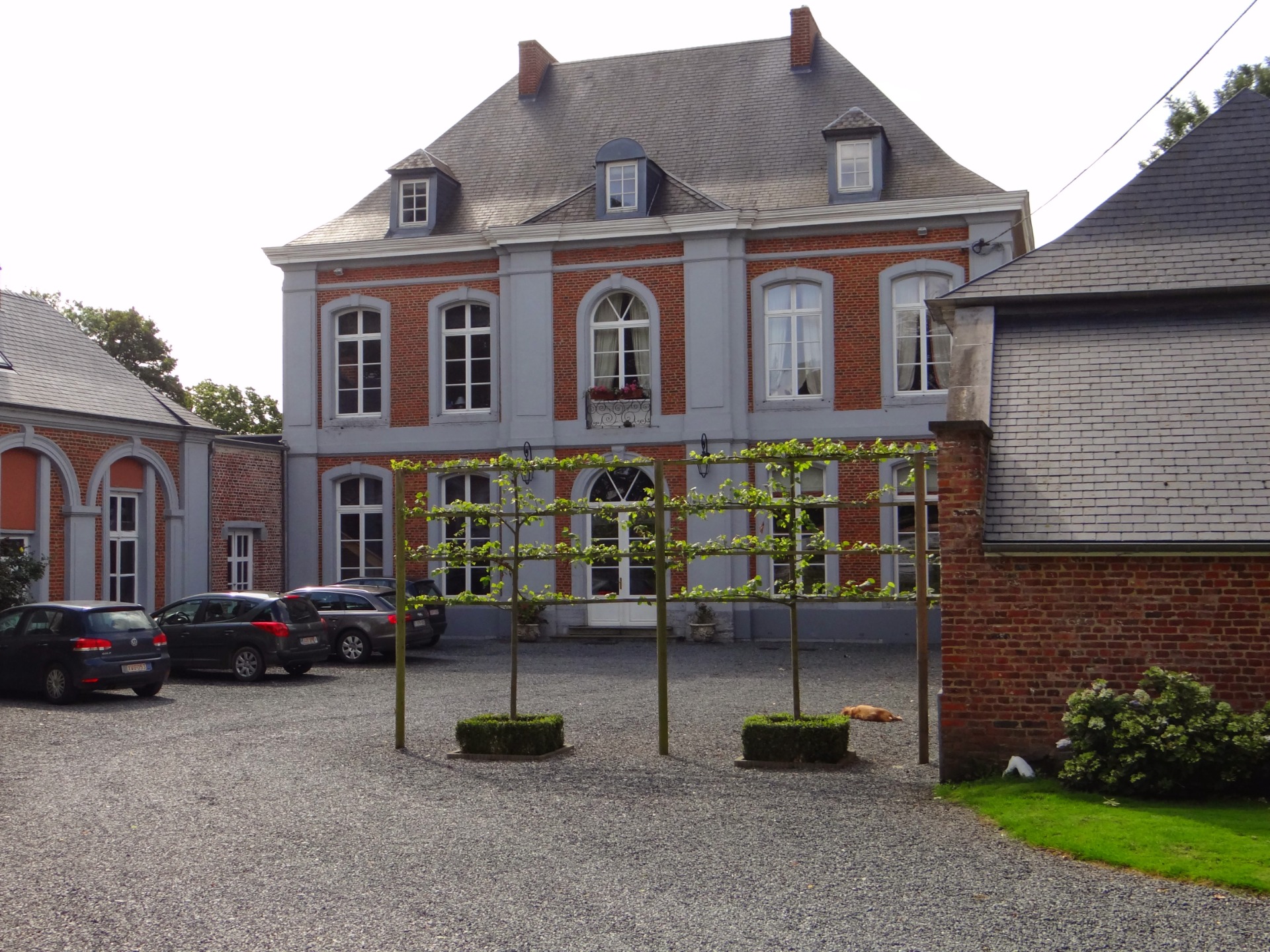
A castle, established at the entrance to the village, a civil ensemble which once included the school and the town hall and a few potales or chapels complete the architectural range of Montignies. The whole, built of brick, cut stone and limestone rubble for the oldest buildings, generally dates from the 18th and 19th centuries.
Many renovations carried out in the 2nd half of the 20th century somewhat mar the architectural quality of the village, the buildings of which nevertheless retain a real volumetric coherence.